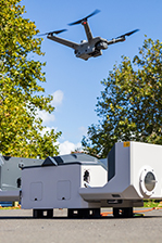
eBee X (S.O.D.A. 3D) Ex DEMO (As new Condiiton)
Lightweight mapping drone for large coverage and sharp data.
Features
Lightweight mapping drone for large coverage and sharp data
eBee X offers 90-minute flights, RTK, PPK, online training, eMotion flight planning software, and more.
Perform professional mapping operations, including flying safely over people and BVLOS, with the NDAA-compliant eBee X drone.
Map smarter and safer
3D, RGB, multispectral and thermal cameras
eBee X is compatible with a wide range of interchangeable photogrammetry cameras that capture reliable aerial imagery – from 3D models to orthomosaics – to suit every mapping job.
1.5 cm / 0.6 in absolute accuracy
With the on-demand RTK / PPK capabilities of survey drone eBee X, you can gather data without ground control points (GCPs) while maintaining a GSD down to 1.5 cm / 0.6 in.
1.6 kg / 3.6 lbs takeoff weight
Operate safely within more regulatory frameworks thanks to the eBee X’s light weight, which extends your operational possibilities – BVLOS and flights over people – and range.
eBee X has the best ratio energy / MTOW compared to heavier VTOLs.
90 minutes flight time
Efficiently map up to 500 ha / 1,235 ac while flying at 120 m / 400 ft eBee X flight time of up to 90 min* makes it the perfect drone for covering large areas.
*With endurance battery and S.O.D.A. camera.
RTK / PPK available
RTK and PPK allow you to ensure more reliability with the accuracy obtained, without ground control points. The eBee X professional drone is compatible with the industry’s leading base stations.
Shock absorbent
Our R&D engineers have designed a shock absorbent drone fuselage with an underbelly made of reinforced polypropylene woven mesh.
Remote ID, C2 and C6
We’ve prepared for U.S. and European drone regulations with eBee X, featuring built-in FAA-approved Remote ID and EU C2 and C6 labeling.
Safety as a priority
Successful impact tests to demonstrate operational safety around people.
Free from hard front plastic parts and rear-facing motor.
Flight planning software integrates fail-safe protocols and live air traffic.
Increase the quality, efficiency and safety of your data collection
Easy to use
The eBee X and its eMotion flight planning software are beginner-friendly, yet packed with advanced features to tackle the toughest jobs. Definitely a smarter way to map.
Easy hand-launch
Designed to restart the mission as soon as the drone lands and to be simply hand-launched.
3 minutes deploy
Operated by one user and easily transported in a backpack with all your gear in one spot.
Automated flight
Automated flight and landing with eMotion mission planning software, which is included.
In the box
WHY BUY FROM US?
By buying from Ferntech, you'll have the confidence that you are dealing directly with New Zealand's leading drone experts. Our staff are knowledgable drone pilots who offer expert advice, trusted support and superior specialist service. Only through us will you receive a full New Zealand warranty, phone and email support, and access to our certified Repairs Centre with DJI-qualified drone technicians. And we guarantee that we will have the best prices on the market — if not let us know and we will match any price (conditions apply).
Warranty Details
There's currently no reviews for this product, be the first to write one.


