DJI AUTHORISED RETAIL STORE AUCKLAND
|
Retail Store Opening Hours
|
|
Monday
|
8:30am – 5:00pm
|
|
Tuesday
|
8:30am – 5:00pm
|
|
Wednesday
|
9:00am – 5:00pm
|
|
Thursday
|
8:30am – 5:00pm
|
|
Friday
|
9:00am – 5:00pm
|
|
Saturday
|
10:00am – 4:30pm
|
|
Sunday
|
Closed
|
There is 30 minutes parking out the front of the store on New North Road before 4pm ( from 4pm the street becomes a clear way).
DJI AUTHORISED RETAIL STORE CHRISTCHURCH
|
Retail Store Opening Hours
|
|
Monday
|
10:00am – 5:00pm
|
|
Tuesday
|
10:00am – 5:00pm
|
|
Wednesday
|
10:00am – 5:00pm
|
|
Thursday
|
10:00am – 5:00pm
|
|
Friday
|
10:00am – 5:00pm
|
|
Saturday
|
Closed
|
|
Sunday
|
Closed
|
We have 8 on-site car parks for customers, and there is additional parking in the South City Shopping Centre carpark.
Service Centre
For warranty and repairs please contact repairs@ferntech.co.nz
To book a service please click here.
Why Buy From Us?
By buying from Ferntech, you'll have the confidence that you are dealing directly with New Zealand's leading drone experts. Our staff are knowledgable drone pilots who offer expert advice, trusted support and superior specialist service. Only through us will you receive a full New Zealand warranty, phone and email support, and access to our certified Repairs Centre with DJI-qualified drone technicians. And we guarantee that we will have the best prices on the market — if not let us know and we will match any price (conditions apply).
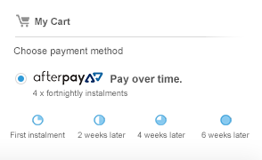
See our finance options and choose the one that would best suit your needs.
Send our team a message


