


Exploring DJI Terra: A User-Friendly Guide with Top FAQ's Answered
DJI Terra is a powerful 3D model reconstruction software, which seamlessly processes your mapping and inspection data by converting it into manageable data sets that physically recreate your environment. In this comprehensive guide, we'll address some of the most frequently asked questions about DJI Terra and provide you with a clear understanding of its updated features, capabilities, requirements, and application usage.
1. What is DJI Terra, and how does it integrate with DJI drones?
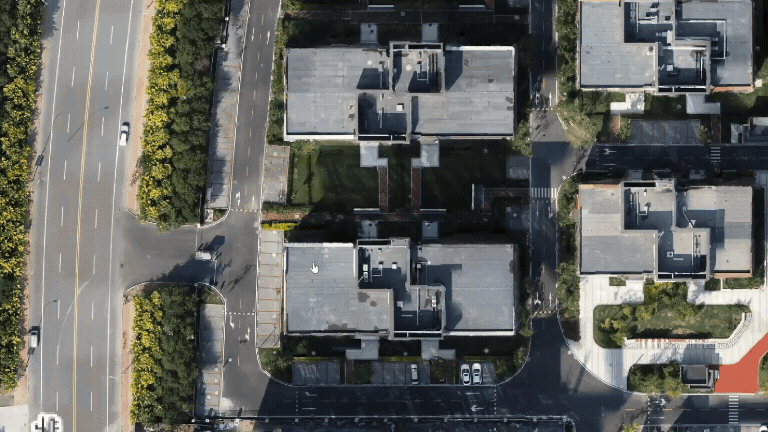
DJI Terra, a 3D model reconstruction software, efficiently processes aerial image data captured with DJI drones. It swiftly converts this data into high quality and accurate digital maps, and enables users to quickly transfer and process their digital maps – whether you're in surveying, construction, agriculture, or other industries. With DJI Terra, you can transform your drone-captured data into actionable insights, adding significant value to your business or work in these industries.
2. What formats can DJI Terra output data in?
DJI Terra supports various standard formats, such as TIFF orthomosaic, LAS point cloud, DXF, and several 3D model formats. This compatibility simplifies integration between DJI Terra's output data and other software you might use, such as GIS (Geographic Information Systems) or CAD (Computer-Aided Design) applications. With the upcoming V4.2 version, DJI Terra will support additional formats like landXML and GeoJSON, making it even more versatile and future-proof.
.gif)
Captured data processing in different formats
3. Can DJI Terra output data in different coordinate systems?
DJI Terra offers over 8500 built-in common coordinate systems, allowing users to select a system by name or EPSG code. Additionally, it supports the import of PRJ files and the use of seven-parameter transformations to customise coordinate systems. This flexibility simplifies the integration of data with various GIS, CAD, and other third-party data application software.
What are the computer system requirements for 2D and 3D reconstruction with DJI Terra?
To get the best performance from DJI Terra, you'll need a computer running Windows 10 or above (64-bit). The hardware requirements depend on the complexity of your project:
- Minimum Requirements: 32GB RAM and 4GB graphics RAM (Nvidia graphics supporting shader model 6.1 or better).
- Recommended Requirements: 64GB RAM or more and Nvidia 2070 graphics or higher.
The more advanced your hardware, the better your performance. For example, every additional 10GB of free memory allows you to process 4000 more photos. This means you can tackle larger projects more efficiently without compromising the quality of your models.
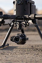
5. Can ground control points (GCPs) be used to process LiDAR data in DJI Terra?
Yes, DJI Terra supports the use of Ground Control Points (GCPs) to improve the elevation accuracy of LiDAR data. You can also import Check Points to verify the accuracy of your LiDAR data. This feature is especially valuable for projects that require high precision, such as topographic mapping and infrastructure monitoring.
-1.gif)
GCP's placed onsite and recorded as data on DJI Terra.
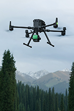
6. Can Zenmuse L1 & L2 raw data be processed without an RTK connection? Can the same data be processed during a regular GPS flight?
Yes, you can process both Zenmuse L1 and Zenmuse L2 raw data without an RTK connection, using a method called post-process kinematic (PPK). You'll need to add a base station observation file (such as Rinex, RTCM, OEM, or UBX) and additional raw data to the L1/L2 raw data folder. This ensures you get accurate point cloud files without a direct RTK connection during a flight.
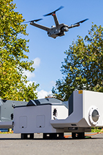
7. Is it possible to merge data from multiple flights from the Zenmuse L1 & L2 into a single Point Cloud in DJI Terra?
Yes, merging data from multiple flights is not only possible but incredibly easy and straightforward within DJI Terra. Simply import multiple raw data folders from your L1/L2 flights, check the "Merged Output" option, and DJI Terra will combine them into a single LAS file. This process is perfect for large-scale mapping projects requiring multiple flights over extended periods, such as building large-scale stadiums and commercial real estate.
Using DJI Zenmuse L2 and DJI Terra to assist constructing Everton FC's new stadium.
8. Can I share my output files from DJI Terra?
Yes! DJI Terra makes it easy to share your output files. Through DJI Modify, you can create a URL link and share it with other team members, clients, or stakeholders. This new feature streamlines collaboration and ensures that everyone involved has access to the latest data for better-informed decisions and planning.
9. How efficiently can DJI Terra process images from DJI drones?
DJI Terra is designed for high efficiency. Results based on user surveys are as follows:
- 2D Projects: DJI Terra can process around 2000 images per hour, which equals about 5 km² when using the M3E drone to capture images at 5cm resolution.
- 3D Projects: DJI Terra can process about 700 images per hour, equivalent to 0.4 km², with the M3E drone capturing images at 5cm resolution using smart oblique capture.
10. Does the Photogrammetry workflow of DJI Terra support the exporting of high-precision Point Clouds?
Yes, it does. In addition to creating 3D models, DJI Terra can export high-precision point clouds in formats like LAS, PLY, and PNTS. The upcoming V4.2 version will further enhance the quality of these point clouds, making them even more accurate for various applications.

SPEAK WITH A SPECIALIST
Contact our team today to discuss the right solution for you.


