


Case Study: How Recon Uses DJI Drones and LiDAR for Surveying
As one of New Zealand’s leading land surveying and mapping businesses, Recon has embraced aerial drone and LiDAR technology for more efficient, cost-effective visual data capture. We have worked with Recon for several years, and recently caught up with Managing Director Jeremy Neilson and Operations Manager Ben Cook. Read on to learn how they started with drones, how this technology has evolved, and how the DJI Zenmuse L1 and L2 LiDAR solutions have transformed their surveying and mapping operations.
How did you first find out about drone technology, and what was your first experience like using them?
My (Ben’s) first introduction to drone technology was through surveying, working with Jeremy and his background in aerial mapping. We were using drones to get ground data through photogrammetry point clouds. The first experience using drones was very clunky – they were fixed wing and would take about an hour to set up, and you would have to launch them with a catapult and land them with a parachute. So it was nothing like the multirotor technology that we utilise today.
How has drone surveying changed since you first started?
When we first started using fixed wing drones, mapping them using a grid, they would often fly with the wind and they would go off course. With multirotor drones following GPS coordinates very accurately, we can have really accurate grids which helps with our surveying. We’re also able to adhere to the rules of flying drones over here, in that you can fly grids and stop at boundaries, so we can digitally enter boundaries for drones to fly. All of that has changed since we first started operating them.
What are your key project types, and what are the main challenges you face?
Recon’s a surveying and aerial mapping company, so we do mostly aerial mapping from unmanned aircraft and on occasion we do this from manned aircraft as well. We also do a bit of 3D laser scanning in there. In the last few years we’ve been focusing a lot on LiDAR capture – that’s really driven from the fact that a lot of our projects can be over very difficult terrain, so we could be flying over cliffs or rivers, particularly last year after the weather events, but also flying over forests and vegetative areas as well. So to get a good terrain model under those areas, the LiDAR’s pretty critical.
Drone technology moves very fast, so another issue we face is keeping up with what’s available. One of the best things about that is that we’re able to operate more safely. Public interest in drones is changing as we’re seen more in the sky, and sometimes that can cause us issues too.
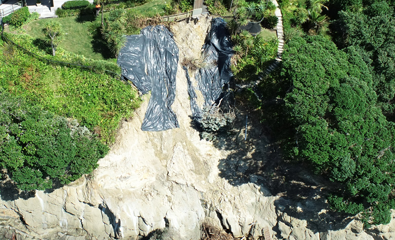
Oblique photo of a landslide
What drone and LiDAR solutions are you currently using?
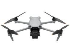
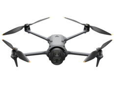
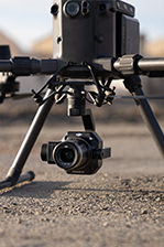
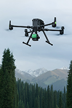
We currently have a fleet of DJI drones. Our main use is the DJI Matrice 300, and we operate both the L1 and L2 LiDAR payloads using that technology.
What benefits and key results have you seen by using LiDAR payloads?
So there are really two main ways of mapping from a drone. The first is photogrammetry, which uses photos and is the science of triangulating pixels to make the surface. The second way is LiDAR, which involves an active sensor that sends out light pulses, and those are better at finding gaps in the vegetation. So if you’ve got a site that is heavily vegetated or it has long grass and scrub, the LiDAR sensor is the only option that’s going to get a decent ground model below that.
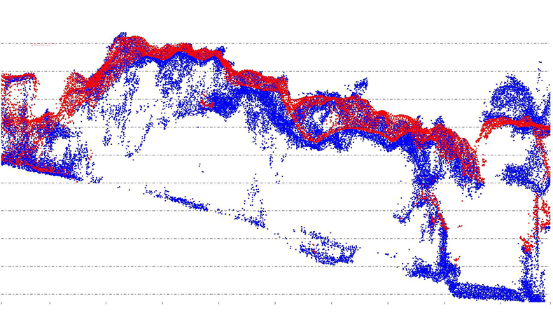
Survey of a landslide, LiDAR (blue) & Photogrammetry (red): LiDAR offers superior ground detail, capturing more precise elevation and surface information compared to photogrammetry.
What does the final LiDAR data look like, and what does it allow you to do?
When we’re capturing LiDAR we’re capturing photos simultaneously with the integrated camera. What that allows us to do is firstly colourise the point cloud so that we can get some good colour context to the data we’ve captured, but also we can process up ortho photos and they can be imported to the client’s CAD or GIS system. From the point cloud, which is really the primary aspect of the capture, we’ll take that through a classification routine. So we’ll classify that point cloud into vegetation, buildings, or power lines, you name it. Primarily the goal is the ground. From the ground point cloud, we then generate the deliverables that the client will take, and that is often contours, or a TIN model, or it could be even the ground point cloud itself some clients prefer to work with.
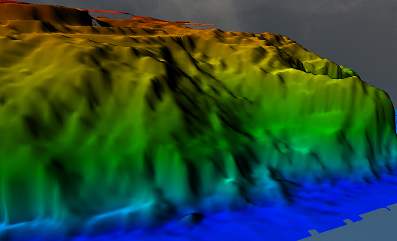
LiDAR DTM (Digital Terrain Model) of a landslide
What does the future of LiDAR use look like for Recon and New Zealand? Are there any changes you'd like to see?
I think LiDAR is going to be used more and more within Recon. We’re able to process data sets faster than photogrammetric data sets, so that’s a big advantage to us and to our clients. Advances in technology we’d like to see… range is always important. So with the L2 we can fly a bit higher utilising our 102 privilege – this means we can cover a wider area in a shorter space of time. We’d also like to see the cost decrease, and some changes in technology where the LiDAR can utilise the drone and actively follow terrain.
More and more survey companies are utilising drone technology. As we see the safety increase on the systems, we’d also really like to see the ability to fly in areas that we couldn’t, as CAA’s understanding of those improvements evolves.
What has your experience been like working with the Ferntech team?
Really positive. They’re a switched on team, we’ve been buying drones off them for a number of years, also cameras and the LiDAR systems obviously, and the Ferntech team also handle our 102 servicing. They’re very quick to respond to any questions we have about utilising their technology, and it’s been great to work with them.
Are you interested in using drones and LiDAR for your own projects? Get in touch with our team via the form below for more information or a quote – we're happy to help.
SPEAK WITH A SPECIALIST
Contact our team today to discuss the right solution for you.


